Folds are structures that formed when one or a stack of layers are buckled, bent, curved or draped as a result of deformation. They vary in size from hand-sample (Figure 1), outcrop (Figure 2), and to large regional scale (Figure 3). They are fascinating structures in all scales. The hand sample in Figure 1 shows folds of varying amplitudes and wavelengths and are likely due to viscous deformation of multi-layers of anhydrite/gypsum and mudstone (Johnson and Fletcher, 1994; Pollard and Fletcher, 2005). Examples of similar folds have been given by Callan Bentley in a blog (http://blogs.agu.org/mountainbeltway/2014/06/20/friday-fold-castile-formation-state-line-outcrop/). The photo shows a relationship between the layer thickness and the wavelength of the folds. Folds with larger wavelengths and amplitudes occur in thicker layers. The outcrop example in Figure 2 shows a series of chevron folds with straight limbs and sharp hinges in turbitide rocks in multi layers of stiff and soft rocks which crop out on the eastern cost of Lago Grey in Chilian Patagonia. The largest scale example in Figure 3 is an asymmetric dome in tens of kilometers in extent and with a steeper eastern limb which is most likely underlined by a series of dip-slip faults in the basement at depth (Davis, 1999).
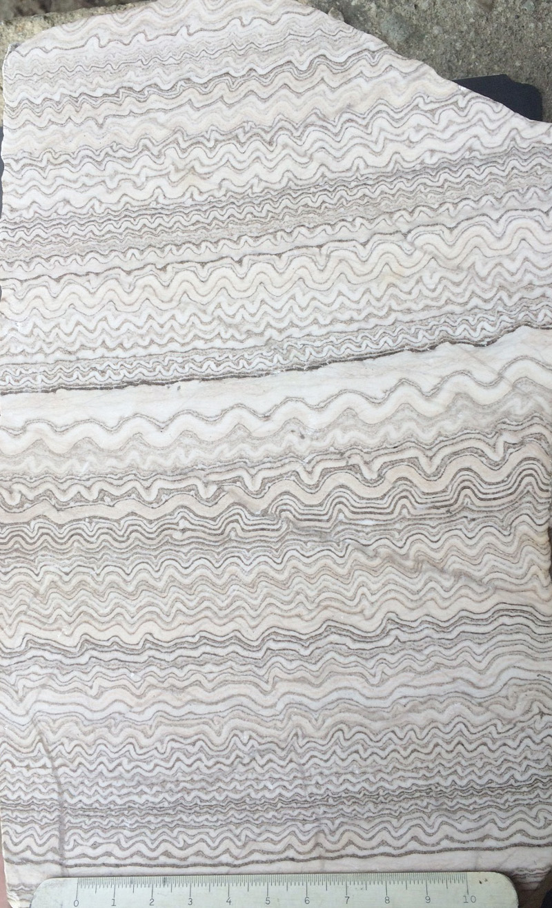 | Figure 1. Folded multi-layers of anhydrite/gypsum (light) and carbonaceous mud (dark) of Castile Formation, Carlsbad, New Mexico, USA. 10 cm ruler for scale. Photo by A. Aydin. |
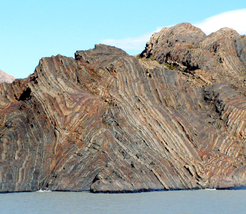 | Figure 2. A series of anticline and syncline folds with a wavelength of several hundreds of meters in turbidite rocks exposed at the eastern boundary of Lago Grey, Chilean Patagonia. |
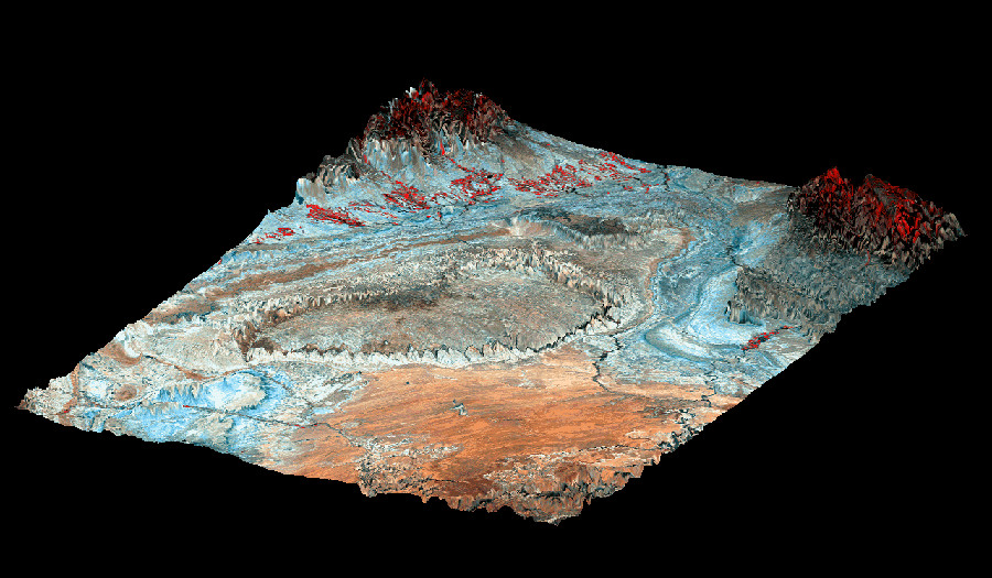 | Figure 3. Satellite image of the San Rafael Swell, Utah, which is an approximately NS trending anticline of more than 100 km in length and made up of Paleozoic (at the core) and Mesozoic (at the limbs) of sedimentary rocks. |
However, Folds are not the focus of this Knowledgebase. So, aside from this link which includes a few cases,it is just a space holder for those who may want to expand it in a manner that we have done for Fractures.
Davis, G.H., 1999
Johnson, A.M., Fletcher, R.C., 1994
Pollard, D.D., Fletcher, R.C., 2005
Copyright Rock Fracture Knowledgebase 2017 | Term of Use | Acknowledgement | Readme