| ||||||||||||||||||
|
|
||||||||||||||||||
|
|
||||||||||||||||||
| Faults | ||||||||||||||||||
|
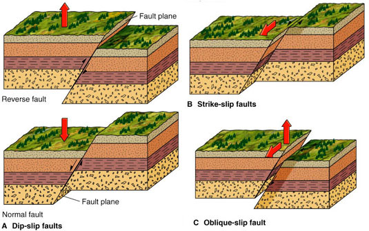
'Civilization exists by geologic consent' Will Durant. Faults are common and important geological structures across which the predominant displacement discontinuity is parallel to the plane of the structure. They are also referred to as shear fractures generally in the engineering literature. In the geological literature, faults have been traditionally classified based on the sense displacement as strike-slip, dip-slip, and oblique-slip faults (Figure 1), see for example, any structural geology text book.
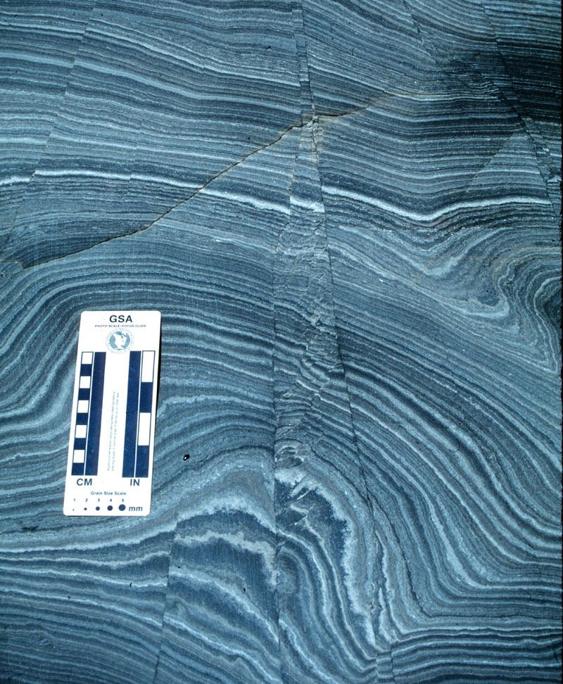
Except quarries and mines, it is very seldom that a fault can be seen in 3D as in the block diagrams in Figure 1. In fact, views of natural faults are commonly available on irregular surfaces at an arbitrary angle to the orientation of faults (Figure 2). This means that key offset markers commonly are not observable, and if they are, the offsets are 'apparent.' Fault surface features may reveal the actual direction of the slip across faults and this information would unambiguously define the fault type as illustrated in Figure 1. There are other features that reveal the kinematics of the fault motion. For example, the splay fracture orientation or pull-aparts can reveal the slip direction. Please see the section under 'Splay Joints', 'Splay Pressure Solution Seams', and 'Echelon Faults.' For large active faults with adequate seismological data, focal plane solutions may be used to determine the sense of motion.
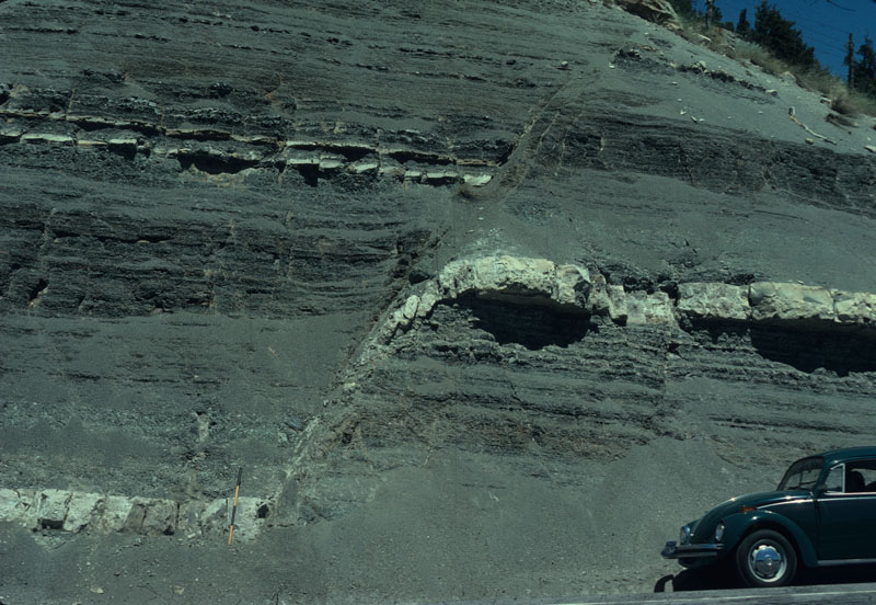
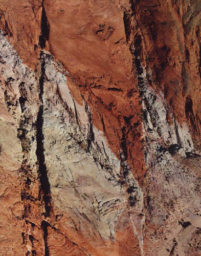
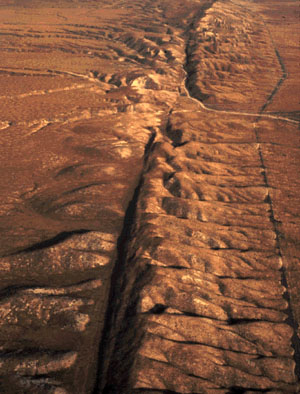
High quality seismic data from reservoirs provide the best 3D view of relatively larger faults. Unfortunately, these generally lack the exact slip directions and high enough resolution to image the fault zone and the associated damage. In essence, there is no single approach to extract all the essential fault properties. The best that one can do in each data set is to use the fault knowledgebase to make the best inferences possible. Faults occur in a wide range of scales, from small ones with a few millimeters to a few centimeters offsets (Figure 2) to medium size faults with meters (Figure 3) to hundreds of meters of offsets (Figure 4). As the fault offset increases, so does the fault complexity. Finally, large scale faults with a few 1000 kilometers in length and over 100s of kilometers offsets, like the San Andreas Fault (Figure 5), are truly crustal scale and form tectonic plate boundaries (Wallace, 1990).
Detailed properties of the components, geometry, patterns, and scaling of faults are discussed under various classes similar to other structural elements discussed earlier. For the time being, we note that faults commonly consist of components referred to as cores, slip surfaces, fault rocks (gouges), damage zones, and splays. Faults change the petrophysical properties of the host rocks in which they occur, like permeability, porosity, and capillary pressure and these are discussed under 'Properties of Faults.' The formation of faults is presented under the 'Mechanisms and Mechanics of Faults.' 'Case Studies' also include faults and assemblages of faults with excellent images and maps. | ||||||||||||||||||
| Types of Faults: | ||||||||||||||||||
| Echelon FaultsComposite FaultsSplay FaultsConjugate FaultsRiedel ShearHybrid Faults | ||||||||||||||||||
| Reference: |
||||||||||||||||||
| Aydin, A., 1973 Flodin, E.A., Aydin, A., 2004 Twiss, R.J., Moores, E.M., 2006 van der Pluijm, B.A., Marshak, S., 2004 Wallace, R.E., 1990 |
||||||||||||||||||
|
Readme | About Us | Acknowledgement | How to Cite | Terms of Use | Ⓒ Rock Fracture Knowledgebase |
||||||||||||||||||